Yard Drainage Plan: How to Map, Choose and Budget
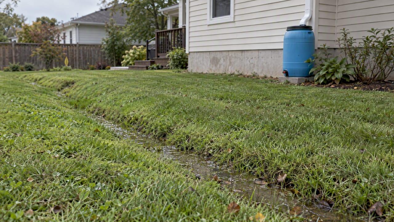
A good yard drainage plan is a drawing, not a shopping list. It shows where water comes from, where it goes today, where you want it to go, and which fix handles each stretch of that path. Do that on paper first and you can pick a French drain, a swale or a regrade with confidence, and hand a contractor a scope they can price accurately.
This guide walks through that process: sketching the property, watching a real storm, choosing a solution, keeping water off the neighbors’ land, and budgeting the full job.
TL;DR
- Sketch the property first: house, hard surfaces, downspouts, slopes, and the nearest ditch, storm drain or stream. Then watch it during a rain and draw arrows for the water.
- Match the fix to the problem. Small wet spots often need regrading or water-tolerant plants. Widespread wetness calls for swales, French drains or catch basins, plus capture such as dry wells or rain gardens where soil allows.
- Every plan needs an outlet. Redirected water that is not soaked into the soil can become the neighbor’s problem.
- Budget more than the trench: pipe, gravel, fabric, rentals, permits, restoration, maintenance and a contingency.
- Call 811 before digging. In Idaho, that means at least two business days ahead.
Table of Contents
- Start with a site sketch
- Watch the water, then draw it
- Choose a fix that fits the problem
- Give the water somewhere to go
- What a drainage plan should include for pricing
- Safety and permits before the first shovel
- Our perspective: draw it before you dig it
- Put your plan on a map
- Frequently asked questions
- Sources
Start with a site sketch
Before you compare drain types, draw the yard. The USDA’s Natural Resources Conservation Service hosts a homeowner guide that starts with a property sketch showing boundaries, the house and foundation, outbuildings, driveways, bare soil, major vegetation, and the nearest stream, storm drain or ditch. Snohomish County’s rainscaping guide adds slopes, planting beds, and existing drainage features such as downspouts, pipes and underground systems.
A satellite view makes this faster and more accurate than pacing the yard with a tape. If you want to draw on aerial imagery and keep the measurements, our backyard layout guide shows how to lay out a yard on a map.
What to put on the sketch
Sort the water sources the way the county guide does. Each one behaves differently:
- Roofs: every downspout, and where each one discharges.
- Decks and stairs: water that drips through or runs off the edges.
- Patios and walkways: hard surfaces that shed water in one direction.
- Driveways and parking areas: the biggest single source on many lots.
- Soils, yards and slopes: bare dirt, lawn and any grade that funnels flow.
Snohomish County’s guide divides runoff sources into these same categories. Mark the approximate square footage of each hard surface. That number matters later, because more pavement means more runoff, and some cities limit it. Our guide to mapping impervious surface explains how to total it.
Watch the water, then draw it
A sketch shows what is there. A storm shows what the water does about it. The NRCS guide suggests walking the site after one or two good rain events exceeding 1/2 inch, drawing arrows for water movement and taking photographs.
What to look for while it rains:
- Where water leaves each downspout and where it goes next.
- Where it sheets across lawn or pavement, and where it concentrates into a stream.
- Where it stops: ponds, soggy turf, a low corner against the foundation.
- Gullies, bare patches and silt fans, which show where flow has been strong over time.
The 2023 Appalachian Rainscaping Manual recommends confirming flow paths by watching rain, measuring relative elevations with a site or hand level, and marking ponding, gullies, erosion and sediment deposits. It also stresses that your eyes can fool you on flat residential lots, so measured elevations improve the layout. If you want a simple way to measure fall, see our walkthrough on calculating yard slope over 10 feet.
If your plan sends water to a basin or pond-style feature, sediment is the long-term issue. Guidance on retention pond maintenance covers what builds up over time and why it is worth tracking from the first storm you photograph.
Check the soil
Where water goes depends on how fast the ground takes it. The NRCS guide calls soil infiltration and rainfall rates critical information, and notes that poorly infiltrating soils are not recommended for many practices. A quick home test: dig a hole about a foot wide and 18 inches deep, fill it with water, and time how long it takes to drain. Do it in more than one spot, because clay in one corner and loam in another is common.

Persistent wet areas often point to a cause you can name. Northern Virginia’s soil and water conservation district says they commonly indicate improper grading or poor infiltration from compaction, clay or shallow bedrock. Knowing which one you have changes the fix. Grading problems can be regraded. Clay or bedrock may need drains that carry water away rather than soak it in.
Choose a fix that fits the problem
There is no single best drainage system. EPA notes that the best residential option depends on community goals, local laws, site feasibility and the owner’s preferences. Here is how the common choices line up against what your arrows show.
| Problem on your sketch | Likely fix | Works best when |
|---|---|---|
| One small low spot that stays wet | Fill and regrade, or plant water-tolerant native plants | The spot is shallow and water has a way out once graded |
| Sheet flow across the lawn | Swale (shallow vegetated channel) | There is gentle slope and a clear outlet |
| Wet ground from a high water table or seep | French drain | Water must be carried away below the surface |
| Water pooling at a patio or driveway edge | Channel (trench) drain | A paved area needs to shed water quickly |
| Roof runoff soaking the foundation zone | Downspout extensions, diverters, rain barrel or rain garden | Water can be piped well away from the house |
| Runoff you want to soak in on site | Dry well, infiltration trench or rain garden | Soil drains well and the spot is away from the foundation |
Small wet areas versus widespread wetness
Fairfax County’s guidance splits the options the same way. For small wet areas after storms, replant with water-tolerant, preferably native plants or fill and regrade the depression. For widespread wetness, it points to swales, French drains, catch basins and downspout extensions to redirect water, and rain barrels, cisterns, dry wells, soil amendment and rain gardens to capture it.

French drains and channel drains
A French drain is a gravel-filled trench with a buried perforated pipe, typically wrapped in filter fabric, and it handles mainly surface water and sometimes groundwater. For patios, walkways and driveways, the same Government of Canada page says a grated trench or channel drain can collect and redirect surface water from paved areas. The principle applies on any US lot, even though that page is Canadian.
Dry wells, infiltration trenches and rain gardens
These soak water into the ground, so soil matters. EPA says dry wells and infiltration trenches are most practical where soils infiltrate well. Fairfax County warns that rain gardens and dry wells should not sit next to the foundation, and that poor infiltration, high groundwater or shallow bedrock may require an underdrain or make the practice unsuitable. Run the infiltration test before you commit.
Roof water and air-conditioner condensate
Roof runoff is the easiest source to control and the most often ignored. Map every downspout and send its flow to a rain garden, rain barrel or other suitable spot. The NRCS guide also names downspout diverters as an option. Treat condensate lines the same way: put the discharge point on the sketch and make sure it ends on a slope that carries it away, not into a low pocket against the wall.
When the yard has a retaining wall
If the slope is held by a wall, drainage behind it is part of the plan, not an afterthought. Our guide to mapping retaining wall drainage and choosing filter fabric covers what to mark on the drawing.
Give the water somewhere to go
The most common mistake is a plan that collects water but never finishes the route. Fairfax County is direct about it: redirected runoff needs a suitable outlet, or the problem moves downhill and may affect neighboring properties if it is not soaked into the soil.
A workable outlet check on your sketch:
- Trace each pipe or swale to its end point. Is it on your lot, on soil that can absorb it, or at a street, ditch or storm drain you are allowed to use?
- Keep the discharge well away from the foundation and from the property line.
- Look at what sits downhill. If your neighbor’s low corner is already wet, a new concentrated flow will make it worse.
- Check your city or county codes. Rules on discharging to the street, a ditch or an adjoining lot vary by place.
In dry western climates such as Idaho and Utah, there is a second consideration: storms are short and intense, and the soil may be hard and crusted. Water that runs off quickly can still do damage. If you are also thinking about reducing irrigation, see how drainage and planting choices fit together in our guide to water-wise landscaping in Utah.
What a drainage plan should include for pricing
Contractors price what they can see. A drawing with measurements gets you a tighter bid than a phone call saying “water pools in the back.” Include:
- Lengths and widths: trench length, swale length, drain runs, and the area to regrade.
- Depth and slope: how deep the trench needs to be and the fall along the route.
- Surface type: lawn, planting bed, gravel, concrete or asphalt that has to be cut or restored.
- Connection points: downspouts, catch basins, outlets and the end of each run.
- Photos: wet areas after a storm, the downspout outlets, any gullies or silt.
- Access: gates, fences and narrow side yards that limit equipment.
Budget for the full project, as municipal guidance does. Rockville, Maryland’s homeowner guide advises researching solution-specific costs and including pipes, gravel, landscaping fabric, drainage basins, equipment rental, permits and fees, post-project landscaping such as reseeding or sodding, ongoing maintenance, and contingency funds. Restoration and maintenance are the lines most DIY budgets miss.
If the plan involves new paving, such as a patio or a concrete pad that will shed water, include its dimensions and slope too. You can measure it with our concrete estimator.
Safety and permits before the first shovel
Drainage work means trenching, and trenching means utilities. New Hampshire’s homeowner guide directs you to confirm underground utilities before installing a stormwater practice. In our Idaho and Utah markets, that starts with 811. Idaho Power’s guidance says to call 811 no less than two business days before you dig, and to hand dig within 24 inches of either side of marked lines. Locate tickets there are valid for 28 days, so call again if the project slips. Utah homeowners use the statewide 811 center, Blue Stakes of Utah.
Permits depend on where you live. Fairfax County, for example, requires a permit when disturbing more than 2,500 square feet for certain rain gardens or dry wells, and tells residents elsewhere to check their own codes. Call your city or county building or public works office before you finalize the plan, especially if water will leave your lot or cross an easement. Large regrades near a property line deserve a call to a licensed civil engineer or drainage contractor.
Our perspective: draw it before you dig it
Most drainage disputes we see described come down to the same gap: the homeowner knows water is a problem, but the contractor never sees the whole property. A generic number for “drainage work” cannot reflect a 90-foot run along a fence line, a downspout 12 feet from a patio, or a clay corner that will never soak anything.
That is why we built our platform around the map. You draw the exact location of each element on aerial imagery, see the dimensions, adjust the design, and get a local, site-specific range before anyone visits. Contractors then receive a scope packet with drawings, measurements and photos rather than a vague request. For drainage, we think the best habit is simple: put the arrows from your rainy-day walk on the same drawing as the fence, deck, pad or wall you plan to build, so each project accounts for the others.
— Christian
Put your plan on a map
Once you know where water flows, you can place every related project on one drawing: the patio that needs a channel drain, the fence that crosses a swale, the retaining wall that needs drainage behind it. Our platform lets you draw them on your own property, with no account required, and see local price ranges for each.

Start with the local project report for your address, or open the estimators on our home page to map a specific project. When you are ready, request quotes with the drawing and measurements attached.
Frequently asked questions
What is the first step in making a yard drainage plan?
Sketch the property with the house, hard surfaces, downspouts, slopes and the nearest ditch, storm drain or stream. Then watch the yard during a real rain and draw arrows showing where water travels and where it collects. That drawing tells you which fix to consider.
Do I need a French drain or a swale?
A swale suits sheet flow across a lawn when there is gentle slope and a clear outlet. A French drain suits wet ground where water has to be carried below the surface, because it is a gravel trench with a perforated pipe. Your arrows and soil test will usually make the choice clear.
How do I handle patio drainage?
For a patio, walkway or driveway, a grated trench or channel drain collects surface water and redirects it. Plan where the drain discharges before you buy anything, and keep the outlet away from the house and the neighbor’s property.
Will redirecting water cause problems for my neighbors?
It can. Water that is moved and not soaked into the soil may affect properties downhill. Trace every pipe or swale to an outlet on your own lot, a legal street or ditch connection, or soil that can absorb it, and check local codes first.
Sources
- Slow it. Spread it. Sink it! Home Drainage Guide (NRCS)
- Rainscaping Guide (Snohomish County)
- Site Assessment: Methods & Recommendations (Appalachian Rainscaping Manual)
- Wet Yard: Solving Drainage Problems (Northern Virginia SWCD)
- Control Heavy Runoff (Northern Virginia SWCD)
- On-Lot Treatment, Stormwater Best Management Practice (EPA)
- French drains, trench drains and weeping tiles (Government of Canada)
- Go With the Flow! A Homeowner’s Guide (City of Rockville)
- New Hampshire Homeowner’s Guide to Stormwater Management
- Call Before You Dig (Idaho Power)
- Retention pond maintenance for homeowners